This walk takes you through a newly-planted area along the Okana River. It begins on the Little River side of the bridge over the Okana, just by the Domain.
This is perhaps the easiest walk if you’re feeling less energetic. It begins in the centre of town, crosses the Okana River at Kinloch Road, and proceeds down Pa Road, returning onto State Highway 73, and then back to the village.
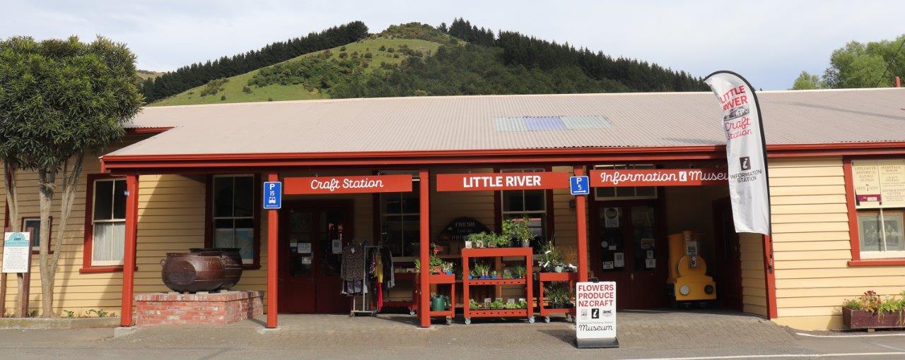
Another less strenuous walk, the River Walk begins opposite the Little River Hotel (just on the Christchurch side of the village).
More specifically a cycling track, the Christchurch-Little River Rail Trail follows the former path of the railway line. The Little River Branch Line opened in 1886. It became progressively more uneconomic, and finally closed in 1962. A good walk would be the 9km to Birdling’s Flat, where you could extend your walk down to the beach. Great for bird watchers.
Because this walk traverses farmland, it remains closed between August and October each year, due to lambing. Outside of these dates please remember to leave gates as you found them, to prevent stock wandering into uncontrolled areas. The walk itself is a relatively steep uphill climb of around eight kilometres, beginning at the Okuti Reserve, and ending at French Peak. Allow a good two and a half hours. Check the weather before setting out, and carry extra clothing and water.
A quite gentle walk of around 30 minutes return, through native bush of totara, mahoe, kanuka, etc. To get there, proceed up Okuti Valley Road, past the campground, until you see some picnic tables on your left. This is the best place to leave your transport, and walk up Reserve Road until you see the gate to the walk on your left.
This track begins at the top of Kinloch Road, where it intersects with Bossu Road. Turn right at the T intersection, into Bossu Road, and you will see a sign announcing whether the track is open or closed. Again, this is farmland, so be aware of stock, and leave gates as you found them. It’s a relatively easy 6km walk down to the beach, with great views, but unless you’ve arranged transport back, allow for a good two and a half hour grind back up.
At its high point, and on a clear day, this walk affords excellent views over much of the Peninsula, from Onawe and Akaroa Harbour, back to Wairewa/Forsythe, east towards the sea, and back to Mount Herbert. On Bossu Road, just past the Reynolds Valley Road intersection, are some cattle yards. The track begins there, and is marked to the summit. Reasonably strenuous going up. Allow an hour and a half each way, and check the weather first.
Birdling’s Flat is at the outlet of the lake, and from it the spit extends west, dividing Lake Ellesmere (Waihora) from the sea. You can collect gemstones (jaspers, agates, petrified wood, etc.) from the beach, and will sometimes see dolphins, seals, just beyond the surf line. And who knows, you might even be lucky enough to spot a whale heading north. Kaitorete was home to several Maori pa sites, due to the abundant kai moana (seafood) and shore birds. Surf casting from the beach can still be quite productive.
If you just feel like an easy stroll, try the Heritage Park, or the Awa Iti Domain. The Heritage Park is next to the diner, and provides some seating in an environment of native shrubs. The Domain is the venue for the annual A&P Show, and for Rugby and Cricket matches.
A walk through mature native bush, this walk takes you past one of only a few remaining specimens of giant totara (this one is more than eight metres around its trunk, and is estimated to be over 2,000 years old). The track continues, past a sizeable matai tree, on until it connects to the Summit walkway. Access: turn left from State Highway 75 onto the scenic Summit Road at Hilltop, and the track is signposted about a kilometre on, to the left of the road. Allow one and a half to two hours.
The Kaituna Valley Road turns off State Highway 75 between Little River and Motukarara. Travel about 7km up the valley road, and then take the un-named side road for a short distance. The track from there is well sign-posted, initially following a vehicle track. The bush is mostly kanuka and kowhai, and is quite rich in bird life. The track eventually leads to the Packhorse Hut, which has mattresses, a wood fire and tank rain water, which can become exhausted in summer. You can either return via the same track (allow 3-4 hours), or proceed on to link up to the Gebbie’s Pass Track, and then on to the Gebbie’s Pass Road.
The Gebbie’s Pass Road runs from the Blue Duck Café in Motukarara, over the saddle to emerge at the head of Lyttleton Harbour at Teddington. A short distance over the top of the pass, on the Lyttleton side, there’s a small parking area. The track rises gently through forestry, over McQueen’s Pass, past the volcanic formations known as the Remarkable Dykes, and on to the Packhorse Hut. From here, either return, allowing two and a half to three hours, or carry on with an easy stroll down the Kaituna Valley walk.
Mount Herbert is the highest point on the Peninsula, and this the easiest way to access it. Take Western Valley Road, off State Highway 75, at the Akaroa end of Little River Village, and head on up the road to Port Levy. The road becomes unsealed, and can be a bit rough, particularly in winter, when a four wheel drive vehicle is definitely advisable. Snow can also be a potential hazard. At the top of the saddle there’s a carpark, and from there it’s a gentle climb with great views, past the odd stand of totara, and remnants of totara which have been felled or burned. Allow a half day.
This can be accessed from the saddle on the Port Levy/Purau Bay Road, but there is also a branch track from the Mount Herbert track. The Monument is a volcanic remnant, and there is a sixty year old hut, which remains in reasonable condition. It has eight bunks, and a water supply. Three and a half to four hours from the Lyttleton Harbour side.
You will need to arrange transport for this walk, and you can begin at either end. Starting from the Port Levy/Little River Saddle end, you will have proceeded up Western Valley Road to the top of the saddle. The track traverses ridges, and eventually winds down into Montgomery Park. On the way it takes in Mounts Fitzgerald and Sinclair. Much of the walk is gentle country, but there are steep sections. Vegetation on the tops ranges from tussock, and wind- swept, dwarfed totara, along with such alpine plants as Spaniard and Mountain Holly. The old stumps and fallen remnants of large totara will give an impression of what the area would have looked like prior to logging and burn- offs. Allow a half day.
From Hilltop, looking over Akaroa Harbour, you will see a teardrop-shaped spit of land projecting out from the head of the bay. This is Onawe, a volcanic remnant, and once the site of a thriving pa. It is also the scene of a massacre of most of its inhabitants by followers of the Ngati Toa chief, Te Rauparaha, in 1832. Before beginning this walk, it is accepted practice to cleanse your hands in the sea, as a mark of respect for the dead. To access, turn off State Highway 75 at Duvauchelle, and proceed up the unsealed road for about one kilometre, to the carpark. Onawe is most easily accessed at low tide. As the tide level increases, you’ll need to paddle, and then wade, through the rock pools. Once you’ve covered the first couple of hundred metres, the track progresses up a reasonably gentle incline, to the beacon at the summit, and then on to the end of the small peninsula. Deviating from the track will lead you to fairly steep, bush-covered cliffs. Allow about an hour return.
About half a kilometre past Duvauchelle, a sealed road leads down to a slipway. From there, follow Bayview Crescent until you reach the track sign. The track itself is steep in places, and meanders around the peninsula, eventually forming a circuit. A lateral from the main track drops down to a quiet and secluded beach, which is pleasant and sandy from mid-tide on.
Akaroa has many walks that begin in, or near to, the town centre. Principal walks are:
• The Garden of Tane and cemetery (40 minute circuit).
• The Old French Cemetery and L’Aube Hill (Several walks from 30-60 minutes).
• The Purple Peak track (A tough slog up to the summit, then on to Stony Bay – 4-6 hours).
• Stanley Park Walks (40 minute circuit).
The continental shelf drops fairly steeply off the east coast of the South Island, with the consequence that the water is a bit cooler than elsewhere in New Zealand. However, summer temperatures on Banks Peninsula can reach the mid-thirties...
Named after the barque, Magnet, which had the misfortune to run aground there, Magnet Bay is a recognised surf beach. It’s a boulder beach, not so friendly for sun bathers, but with a decent, left hand point break. Check the surf report on http://www.metservice.com/marine/surf/magnet-bay for the latest information. Boulders make the beach dangerous, so Magnet is recommended only for intermediate to advanced surfers. Access is via Kinloch Road, turn right at the intersection with the Bossu Road, then left down towards Tumbledown Bay. You veer right after a few kilometres onto the Magnet Bay Road. Beyond Kinloch, the roads are unsealed, and can be a bit rough. Four wheel drive is good, but not essential.
Once the site of a large Maori population, Tumbledown is now secluded for much of the year. On a busy summer’s day there might be fifty, or even a hundred people enjoying the area. Access is again up Kinloch Road, right into Bossu, and then down to Tumbledown. It’s a gently sloping, sandy beach, and allow for a five minute walk from the carpark. The road is unsealed beyond Kinloch, and can be rough, with one-lane sections and steep drop-offs. Fishing from the rocks may be productive, and you can gather mussels from the rocks at the left-hand end of the beach at low tide. Seals populate the rocky areas to the right. They’ll ignore you, but can be aggressive if provoked.
Continue beyond Tumbledown Bay, and you’ll arrive at Te Oka. The beach is less attractive, and the road climbs over yet another steep rise. So unless you’re exploring, or fancy the drive, stick to Tumbledown.
A few kilometres on the Christchurch side of Little River Village is the small settlement of Birdling’s Flat. Originally a collection of fishing cribs, it is now becoming a more popular place for permanent residents. The beach itself stretches along the length of Kaitorete Spit, with Lake Waihora (Ellesmere) on the inland side. It can be a wild place when a southerly blows, and the beach itself is unsuitable for swimming, due to its steep drop-off and often severe undertow. However, it’s great place for a stroll, with abundant birdlife and gemstones, such as agates and jaspers to be found amongst the pebbles on the stony beach.
The harbour itself has a number of beaches. Some, such as Barry’s Bay, are tidal, and present mudflats at low tide, but others, such as Tikao Bay and Takamatua are pleasant for swimming
Pigeon Bay is one of the earlier sites of European occupation, named in honour of the once abundant kereru (the wood pigeon native to Aotearoa). It’s on the northern coast of the Peninsula, and is accessed by taking State Highway 75 towards Akaroa, and then turning onto the scenic route at Hilltop. The Pigeon Bay Road is signposted, and it is sealed, although steep and narrow. A good beach, with a boat ramp and a nice, scenic walk extending for some kilometres down the eastern side of the bay.
This bay is home to a number of holiday homes, and has a wharf which is now a popular fishing spot. The beach itself is gentle, and ranges from sandy to rocky. Again, access is off State Highway 75, left onto the scenic route at Hilltop, and left again onto the access road, which is steep, winding and narrow, but is sealed.
Okain’s Bay has a camping area, with some basic facilities. There is also a shop, and an excellent museum. The beach is broad and sandy, with a gentle slope. Access via State Highway 75 to Hilltop, left onto the scenic route before taking the access road which, like the others, is steep, winding and narrow, but is sealed.
Possibly a corruption of the original “Bones Bay”, because of the bones (human and otherwise) that persistently became exposed in the shifting sands. A great beach, with safe swimming and a few facilities (toilets, tables, etc.), but with access much as for the other beaches on this coast.
If you’re keen enough, you might consider the hike with your gear worth it, because Raupo is considered one of the best surfing beaches in Canterbury, particularly during a northerly swell. Access is from either the Little Akaloa Road or the Okain’s Bay Road. Then take McHale’s Road as far as you can go, and then enjoy your walk. A beautiful beach in the right conditions, but be careful of the rip.
So called, not because of any hickory trees there, but as a corruption of the original Maori, Waikerakikari (Bay of Angry Waters). It’s a popular surf beach, and because it’s on the end of the Peninsula, facing due east, Hickory is responsive to swells from both the north and the south. You can access this bay by taking the Summit Road scenic route, or by continuing along State Highway 75 towards Akaroa until you reach Long Bay Road (just past Takamatua). At the intersection, take the Hickory Bay Road. Drive carefully: the road is unsealed, and it’s narrow, winding and bumpy, is not as well maintained as some of the others. There’s a carpark at the bottom, and then a fifteen minute walk to the beach. And, yes, the waters can be angry.
The beaches detailed above are those that are more popular. There are many other beaches and bays on the Peninsula, some of which are accessible by sealed road, some by unsealed road, and others that you will need to walk from a carpark to access. Amongst these are Port Levy, Menzies Bay, Decanter Bay, Red Bay, Stony Bay and Flea Bay.
Apart from State Highway 75, roads on the peninsula are secondary routes, and they range from sealed, but a bit narrow, to unsealed, and sometimes quite rough, to four- wheel-drive tracks....
However, if you’re confident taking the roads less well travelled they’ll take you to through some amazing scenery ,and to some beautiful spots. Four- wheel-drive is preferable on the unsealed roads, although many are negotiable in a conventional vehicle during the summer months. If you’re familiar with driving on steep roads, you won’t feel out of place on the Peninsula. If not, remember the following. Drive cautiously, and at a speed you’re comfortable with. Allow drivers behind you to pass when it’s convenient to do so. Don’t drive too closely to the edge of the roads, where there are steep drop-offs. When descending long hills, engage a low gear to assist your braking, and prevent brakes over- heating. Drive according to the weather conditions.
The Summit Road is the scenic route from Hilltop to Akaroa. It’s a quality, sealed road, two lane, although narrower than a normal two-lane highway, but is considered one of the best drives in New Zealand. Parts of the formation of this road date to the mid 1800’s, when cattle tracks were formed to drive cattle between bays such as Pigeon Bay and Akaroa. Further tracks were created from the various bays, but goods continued to be brought in mostly by sea until well into the twentieth century. Consequently a formed Summit Road, linking these various tracks was slow in coming. By 1880 a passable road had been created from Hilltop to the junction known as “The Cabstand”, above Akaroa. It was intended that the road continue down to Akaroa Head, but that was never completed. The road now takes you from Hilltop to Akaroa, along the ridge, with breath- taking view over Akaroa Harbour, Onawe, and north towards Kaikoura. It’s a generally quite gentle road, with steep lateral roads running down to the various bays, and access back to State Highway 75 in several places. Most of these tributary roads are sealed, but they’re narrow and winding. Be cautious of ice on this road during winter, particularly in shaded areas. It will not be among the first roads to be gritted, and can be affected by snow.
The main highway to Akaroa can itself provide attractive scenery. West of Little River, and beyond Cooptown, the road rises steadily to Hilltop, from where, on a clear day, there are picture postcard views over Akaroa Harbour. From here the road descends just as steadily to Barry’s Bay. And so it continues, up and down through the various bays – Duvauchelle, Robinsons Bay, Takamatua, until you eventually wind down the last hill into Akaroa. The road is sealed and good quality, but can be subject to snow and ice in winter, particularly in its higher reaches.
“Bossu”, of course, is French for “Hunchback”, and it refers to the 712 metre peak behind Akaroa (more poetically known as Tuhiraki, or “Glowing Sky” in Maori). The Bossu Road is another ridge road. To access it, take Kinloch Road (Pa Road on most maps, it’s the first road on the right that you come to as you enter Little River from Christchurch), and continue up the long climb until you reach the intersection at the top. Kinloch Road is sealed, but becomes narrow as it gets higher, eventually entering a one lane section towards the top, with steep drop-offs. At the T intersection, you can turn right to access the bays (Magnet, Tumbledown and Te Oka), or you can turn left onto the main stretch of the Bossu Road. From here, the road is unsealed, and can become a bit rough between scheduled maintenance. It’s two-lane for most of its distance, but with steep drop-offs. If you’re not comfortable driving unsealed roads, the Bossu is probably not for you. Travelling along the ridge, you’ll have splendid views over the Little River valley. Various tributary roads run off to the southern bays. None, however, actually provides public beach access. Just before Peraki Saddle, the Reynolds Valley Road will return you back down into Okuti Valley, and back to Little River. Reynolds is unsealed, narrow, winding, and quite badly rutted at the top. Continuing on the Bossu Road, over the Peraki Saddle, you arrive at Jubilee Road, an exceptionally steep and winding road that will take you down to Wainui. Staying on the Bossu will lead you to its junction with the Lands’ End Road. This is a short road, with good views over Akaroa Harbour, but ends at the farm gates. Back at the junction, the Bossu Road hooks round beneath Mount Bossu, where it becomes sealed, and takes you along the western shores of Akaroa Harbour, through Wainui, French Farm, and eventually to the intersection with State Highway 75 at Barrys Bay. The Bossu Road is best avoided during heavy rain, or when snow is forecast. The upper reaches of Kinloch Road, too, can be subject to icing, particularly in its shaded sections.
This is one of the earlier access roads. It begins as an extension of Western Valley Road (turn left at the Akaroa end of Little River village). This route is now sealed to a short distance beyond where it begins to climb, but past that it remains unsealed, with an often quite broken surface. Ideal for four-wheel- drive vehicles, but during fine weather in summer months it is quite passable to ordinary cars. The road passes over the Waipuna Saddle, past the carpark for the Mount Herbert Walkway, and then begins a steady, winding descent down into Port Levy. From Port Levy you can return, through Diamond Harbour, to Lyttleton, and then through the tunnel to Christchurch. Or if you’re feeling adventurous, and have a four-wheel drive vehicle, you can turn right at Port Levy, and take the road to Pigeon Bay. From here you can return via the Pigeon Bay Road to the Summit Road. Again, it must be stressed that these roads are unsealed, and can be quite rough. If you’re not experience in driving such roads, they are perhaps best avoided. Also subject to slips during heavy rain, and ice and snow during winter. Check the status of this road, as it has been closed recently due to slips.
Harmans Track is a short, four-wheel drive route. Access is via Puaha Valley Road, at the western end of Cooptown. It is steep, narrow, and often quite badly rutted. Harmans Track merges back onto State Highway 75 just short of Hilltop. During bad weather, it is probably best avoided, even in four-wheel- drive vehicles.
The Peninsula is a great place for cyclists, from the Christchurch – Little River Rail Trail, to the various off-road routes you can take...
The entire ride is Grade 1, generally easy, although a road bike might find the shingle surface sections a bit challenging. Once you’re out of the city, you pass through a variety of scenery – open pasture land, streams and regenerating bush, and the wetlands of the two lakes, with their varieties of bird and fish life. Sections of the Rail Trail closest to Christchurch are on-road, and begin at a carpark in Shands Road, Hornby. This continues on sealed roads to Prebbleton, and then on to Lincoln. From there to Neil’s Road is both sealed and unsealed, and then from Neil’s Road to Motukarara you are off-road. The trail then skirts the shores of Lake Waihora (Ellesmere) to Kaituna, and then to Birdlings Flat. From Birdlings Flat to Little River the track is along the shores of Lake Wairewa (Forsyth). To complete the entire ride, allow five to seven hours. It’s flat all the way, and doesn’t require a high degree of fitness. There are toilets provided on the way, and rest spots with picnic tables. You can stay overnight in Prebbleton or Lincoln, and there are shops in these villages. The next stop is Motukarara, where refreshments can be bought at the Blue Duck Café. From there to Little River there are no shopping facilities, although there is some accommodation at Birdling’s Flat. A shuttle service is available to return you to Christchurch, or back to Little River, but you will need to pre-arrange this. A nuisance hazard, particularly during spring and early summer, is chironomus zealandicus, a variety of midge, more commonly called “lake flies” by locals. While they’re harmless (they have no mouth parts, so can’t bite), they do swarm, rising in spirals above the wetland areas. During a rising you may encounter literally billions of them, so it is advisable to carry some form of eyewear. A brochure is available from the Information Station, providing further details and maps of the Rail Trail, or you can access their website on: https://www.littlerivertrail.kiwi.nz/
Le Race is an annual, 100km, Christchurch to Akaroa cycle race. Check it out on http://www.lerace.co.nz/
If you prefer to have your route planned out for you, try a company like Natural Highs: http://www.naturalhigh.co.nz/2015/12/cycling-the-banks-peninsula/ They have one, two, three and four day self-guided Peninsula tours, as well as a one day guided Rail Trail tour.
Once you’re off the main road, there are many great cycling routes. Pretty much any of the secondary routes down to bays will afford great scenery, and places to get away from the crowd. The routes are steep and physically challenging, and once you’re off the seal, the roads can be a bit rough.


